Multi-Agent Systems
Design coordinated AI agent ecosystems that collaborate across maps, datasets, tools, and workflows to solve complex geospatial and location-based business challenges with greater speed and reliability.
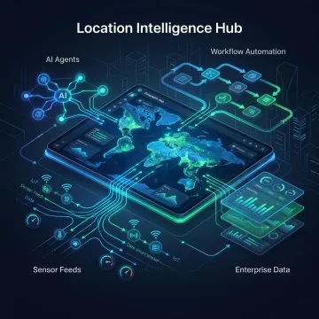
Codewave builds multi-agent AI solutions that connect geospatial data, workflows, and decision systems into one intelligent operating layer. From location intelligence and real-time sensing to predictive analysis and orchestration, we help organizations turn fragmented spatial data into faster actions, clearer visibility, and measurable business outcomes across complex environments.

Specialized AI services that unify spatial data, automation, sensing, and decision intelligence for complex operational environments.
Design coordinated AI agent ecosystems that collaborate across maps, datasets, tools, and workflows to solve complex geospatial and location-based business challenges with greater speed and reliability.
Connect models, agents, geospatial platforms, APIs, and enterprise systems so location intelligence workflows run consistently, scale smoothly, and deliver dependable outputs across operations.
Integrate AI capabilities into existing GIS, analytics, logistics, monitoring, and business platforms without requiring a full rebuild of your current technology environment.
Use historical and real-time spatial data to forecast trends, risks, movement patterns, and operational outcomes that improve planning and location-based decision-making.
Build smart sensing and connected device solutions that capture field data, monitor assets, and feed geospatial intelligence systems with timely, actionable inputs.
Create task-driven AI agents that analyze location data, trigger actions, coordinate tools, and support teams with automated geospatial workflows and recommendations.
Codewave helps organizations build multi-agent AI systems that make geospatial integration practical, scalable, and outcome-focused. We combine agents, orchestration, analytics, and connected data pipelines to transform maps, sensor feeds, enterprise records, and operational workflows into a unified intelligence layer. The result is faster decisions, fewer manual handoffs, stronger visibility, and location-aware automation built around real business use cases.
See how Codewave helps businesses unlock measurable value from AI, data, and intelligent automation.
We build geospatial AI solutions around measurable outcomes, scalable architecture, and direct collaboration.
Worked with 400+ businesses across 15+ industries on complex data and AI initiatives.
ImpactIndex™ aligns delivery around measurable business results, not just technical implementation milestones.
QuantumAgile™ helps validate ideas quickly and move from concept to working solutions faster.
ZeroDX™ removes middle layers so clients work closely with the people building solutions.
Experienced builders of AI, data, and automation systems.
Codewave is an award-winning company focused on turning ideas into high-impact digital products, data systems, and AI-powered solutions. For organizations exploring geospatial integration and location intelligence, our team brings together strategy, engineering, analytics, and automation expertise to build systems that work in real operational settings. We help businesses connect fragmented data sources, validate use cases quickly, and deploy intelligent workflows that create measurable value. Our approach is shaped by direct collaboration, rapid experimentation, and outcome-based delivery models such as ImpactIndex™, QuantumAgile™, and ZeroDX™. Whether the goal is better visibility, faster decisions, or scalable spatial intelligence, we build with business performance, usability, and long-term adaptability in mind.
Multi-agent AI solutions use multiple specialized AI agents that work together across maps, spatial datasets, sensors, APIs, and business systems. One agent may gather location data, another may analyze patterns, and another may trigger workflows or recommendations. This approach is useful for complex environments where decisions depend on real-time coordination, layered data, and location-aware automation.
Talk with Codewave about your data, workflows, and location intelligence goals.

Only Indian company recognized for emergent excellence in self-management, redefining how teams collaborate and deliver value.
Awarded for excellence in digital transformation, driving measurable business impact through innovative and scalable solutions.
Proven across industries and data systems.
Share your use case, current systems, and goals. We’ll help identify the right path for integration, prototyping, or full-scale implementation.
To help us assist you faster, please include the reason for your message so the relevant team can reach out as soon as possible.
To help us assist you faster, please include the reason for your message so the relevant team can reach out as soon as possible.